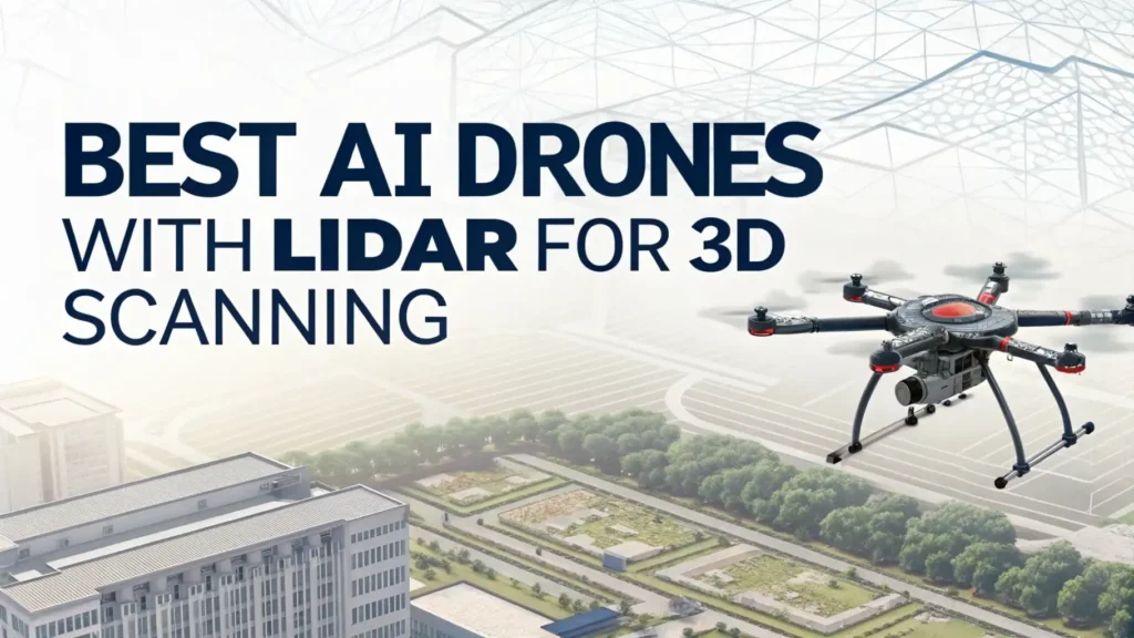
6 Best AI Drones with LiDAR for 3D Scanning in 2026
AI drones equipped with LiDAR technology are changing how we capture and understand three-dimensional space. These advanced flying machines combine artificial intelligence with laser scanning to create detailed maps and models that were impossible just a few years ago.
You can now survey construction sites, map forests, inspect infrastructure, and create digital twins with precision that rivals traditional ground surveying methods.
The integration of AI into LiDAR drones makes them smarter and more efficient. They can automatically avoid obstacles, optimize flight paths, process data in real time, and deliver actionable insights faster than ever before.
Key Takeaways
- LiDAR technology uses laser pulses to measure distances with accuracy down to 1-2 centimeters, creating point cloud data that represents physical surfaces in three dimensions. This beats traditional photogrammetry in many scenarios, especially when working with vegetation or in low-light conditions.
- AI capabilities enhance these systems by enabling autonomous flight planning, intelligent obstacle avoidance, automated data processing, and real-time quality checking. Modern AI drones can make thousands of decisions per second to ensure safe, efficient operations.
- Professional LiDAR drones typically cost between $5,000 and $150,000 depending on range, accuracy, and features. Entry-level systems suitable for small projects start around $5,000, while enterprise solutions with extended range and dual cameras can exceed $50,000.
- Most complete LiDAR drone systems are sold through specialized dealers rather than Amazon, but you can find LiDAR sensors, modules, and some complete scanning solutions on the platform. These range from hobbyist-grade sensors for robotics projects to professional handheld scanners.
- The ideal LiDAR drone setup depends on your specific application, required accuracy, survey area size, and budget. Consider factors like flight time, payload capacity, detection range, point cloud density, and post-processing software compatibility when making your choice.
D500 LiDAR Kit with 360° Laser Scanning

The D500 LiDAR Kit offers an affordable entry point into LiDAR technology for robotics enthusiasts and students. This compact sensor provides 360-degree omnidirectional scanning with a 12-meter detection range. The system works well for indoor mapping, robot navigation, and SLAM applications.
This kit delivers solid performance for its price point. The sensor operates at high frequency to capture environmental data quickly and accurately. You can integrate it with Arduino, Raspberry Pi, or other development platforms using the provided SDK and documentation.
The 12-meter range makes this suitable for indoor spaces, small outdoor areas, and robotics projects. It lacks the range and accuracy needed for professional surveying but provides valuable learning experience with LiDAR principles. The compact form factor allows mounting on small drones or ground robots.
Pros:
- Very affordable price point for LiDAR technology
- 360-degree scanning coverage
- Compatible with popular development platforms
- Good documentation and SDK support
- Compact and lightweight design
Cons:
- Limited 12-meter range unsuitable for outdoor surveying
- Lower accuracy compared to professional systems
- Requires technical knowledge for integration
- Not weatherproof for outdoor use
- Lacks AI processing capabilities
DTOF LiDAR STL-19P Time-of-Flight Scanner

The STL-19P uses direct time-of-flight measurement to deliver 360-degree laser scanning for robotics and mapping applications. This sensor operates at 5000Hz ranging frequency and handles ambient light up to 60,000 lux. The 12-meter radius coverage works well for indoor mapping and autonomous navigation projects.
This LiDAR sensor supports both ROS and ROS2, making integration into existing robotics projects straightforward. The anti-glare capability means it performs reliably in bright indoor environments or outdoor conditions with direct sunlight. The compact design allows mounting on various platforms.
The sensor provides good value for developers and researchers working on SLAM algorithms, autonomous vehicles, or indoor mapping solutions. While not powerful enough for professional aerial surveying, it offers the core LiDAR functionality needed for many robotics applications at an accessible price.
Pros:
- Direct time-of-flight for accurate measurements
- High 5000Hz ranging frequency
- Excellent anti-glare performance (60,000 lux)
- ROS/ROS2 support for robotics integration
- Positive user reviews (4.2 rating)
Cons:
- 12-meter range limits outdoor applications
- Requires programming knowledge
- Not drone-optimized out of box
- Limited technical support
- Basic documentation
Yahboom FHL-LD19 Lidar Sensor for SLAM Applications

Yahboom’s FHL-LD19 provides walnut-sized LiDAR scanning ideal for compact robotics projects. The sensor scans 360 degrees with 12-meter range and withstands 30,000 lux ambient light. This makes it suitable for indoor robots, drones, and autonomous vehicles where space and weight matter.
The package includes mounting adapter and comprehensive SDK with support for Raspberry Pi, Arduino, and other platforms. Documentation covers ROS/ROS2 integration, C/C++ programming, and Python scripting. This makes the learning curve less steep for newcomers to LiDAR technology.
Users appreciate the small form factor and reliable performance for educational and hobby projects. The sensor works well for learning SLAM concepts, building autonomous robots, and experimenting with sensor fusion. While it won’t replace professional surveying equipment, it provides hands-on experience with LiDAR principles.
Pros:
- Extremely compact walnut-sized design
- Good documentation and tutorials
- Raspberry Pi integration support
- Affordable entry-level pricing
- Positive community feedback (4.4 rating)
Cons:
- Limited to 12-meter range
- Not suitable for aerial surveying
- Requires technical assembly
- Basic accuracy for hobby use
- No weatherproofing
Matterport Pro3 3D LiDAR Scanner

The Matterport Pro3 represents a professional-grade 3D scanning solution that combines LiDAR technology with high-resolution photography. This handheld scanner captures indoor and outdoor spaces with trusted accuracy. It creates immersive 3D virtual tours with 360-degree views and 4K photography.
This system excels at creating digital twins of buildings, facilities, and properties. Real estate professionals use it for virtual property tours. Construction teams employ it for progress documentation and BIM integration. Facility managers leverage it for space planning and asset management.
The Pro3 captures spaces quickly and delivers professional results with minimal training. The accompanying cloud platform processes scans automatically and generates shareable virtual tours. While not designed for aerial surveying, it complements drone-based LiDAR by providing detailed interior scans.
Pros:
- Professional-grade accuracy and quality
- 4K photography integration
- Cloud processing and hosting
- User-friendly operation
- Amazon’s Choice designation
- Excellent reviews (4.4 rating)
Cons:
- High price point at $5,995
- Not drone-mountable
- Subscription required for cloud features
- Handheld only (no aerial capability)
- Large file sizes require storage
SHARE SLAM S20 3D LiDAR Scanner

The SHARE SLAM S20 delivers professional surveying capabilities in a handheld form factor. This scanner combines LiDAR technology with a 1-inch sensor camera for high-quality point cloud and photographic data. It achieves 1-centimeter accuracy over a 70-meter range for both indoor and outdoor environments.
This system targets professional surveyors, architects, and designers who need precise spatial measurements. The S20 captures point cloud data and generates 3DGS models suitable for design software integration. The combination of accuracy and portability makes it practical for diverse applications.
While not a drone-mounted system, the S20 complements aerial LiDAR by providing ground-level detail and interior measurements. Professionals can use aerial drones for site overviews and the S20 for detailed building documentation. The workflow integration supports comprehensive project documentation.
Pros:
- High 1cm accuracy specification
- Extended 70-meter range
- Professional-grade sensor
- Indoor and outdoor capability
- Point cloud and 3DGS support
Cons:
- Very high $4,999 price
- No customer reviews yet (new product)
- Handheld only design
- Not aerial-capable
- Learning curve for processing
3DMakerpro Eagle LiDAR 8K Scanner

The 3DMakerpro Eagle offers spatial scanning at 8K resolution for film production, game development, and virtual reality applications. This professional scanner captures environments at up to 140-meter range with color mapping capabilities. The all-in-one workflow handles capture, processing, and export.
This system serves creative professionals who need high-quality 3D assets for digital content creation. Film studios use it for location scouting and virtual production. Game developers scan real environments for photorealistic game assets. VR creators capture spaces for immersive experiences.
The 8K resolution and extended range set this apart from consumer scanners. The color mapping creates photorealistic 3D models suitable for rendering and animation. While not drone-based, it provides the detailed spatial data that complements aerial surveys for comprehensive site documentation.
Pros:
- Impressive 8K resolution
- 140-meter maximum range
- Color mapping capability
- Professional workflow integration
- Suitable for creative industries
Cons:
- Premium pricing at $3,998
- Poor customer rating (1 star)
- Not designed for drones
- Limited to handheld use
- Complex post-processing needed
What to Look for When Buying LiDAR Drones
Selecting the right LiDAR drone system requires careful consideration of your specific needs and constraints. Start by defining your primary application, whether that involves construction site monitoring, forestry management, infrastructure inspection, or archaeological surveys. Different applications demand different specifications.
Detection range determines how high you can fly while maintaining data quality. Entry-level systems offer 100-200 meter range, suitable for small sites and low-altitude work. Professional systems extend to 500-950 meters, enabling high-altitude surveys of large areas with fewer battery changes.
Point cloud density affects the level of detail you can capture. Higher point density reveals finer features but increases data processing requirements. Consider whether you need to detect small objects like utility wires or if general terrain modeling suffices for your purposes.
Accuracy specifications matter greatly for professional applications. Vertical accuracy of 2-5 centimeters meets most engineering and surveying standards. Horizontal accuracy should match your project requirements. Remember that accuracy degrades with altitude and requires proper ground control points.
Flight time and payload capacity limit operational efficiency. Professional mapping drones typically fly 30-60 minutes per battery. Ensure your chosen platform can carry the LiDAR sensor plus any additional cameras or equipment while maintaining safe flight characteristics.
Software compatibility determines your post-processing workflow. Verify that the LiDAR system outputs data formats compatible with your preferred software platforms like Pix4D, DroneDeploy, or AutoCAD. Some systems include proprietary processing software while others require third-party solutions.
RTK/PPK capability dramatically improves accuracy by using ground reference stations or post-processed corrections. This eliminates the need for extensive ground control points and speeds up fieldwork. Consider whether your projects justify the additional cost of RTK systems.
Professional LiDAR Drone Systems Worth Considering
While complete professional LiDAR drone systems rarely appear on Amazon, understanding the market leaders helps you make informed decisions. The DJI Matrice 350 RTK with Zenmuse L3 LiDAR represents current state-of-the-art technology for surveying professionals.
The Zenmuse L3 combines a 1535nm long-range LiDAR with dual 100-megapixel RGB cameras. This system reaches up to 950 meters on surfaces with just 10% reflectivity. The integrated design delivers daily coverage of up to 100 square kilometers with remarkable efficiency.
Freefly Alta X provides another professional option with exceptional payload capacity. This modular platform carries up to 15 kilograms, accommodating heavy LiDAR sensors and additional equipment. Surveyors value its reliability and flexibility for customized sensor configurations.
Autel EVO II RTK series offers a more affordable entry into professional mapping. While primarily photogrammetry-focused, these drones provide centimeter-level positioning and integrate well with third-party LiDAR solutions. The RTK capability ensures accurate georeferencing of survey data.
Most professionals purchase these systems through specialized dealers like E38 Survey Solutions, ROCK Robotic, or directly from manufacturers. These sources provide technical support, training, and warranty services that Amazon typically cannot match for complex professional equipment.
DIY LiDAR Drone Integration Options
Building your own LiDAR drone system offers cost savings and customization potential. Start with a stable drone platform that provides adequate payload capacity and flight time. The DJI Matrice series, Freefly Alta, or similar commercial platforms work well as base platforms.
Select a LiDAR sensor appropriate for your application and budget. The Velodyne Puck series, Ouster sensors, or Livox units provide good performance at various price points. Ensure your chosen sensor includes mounting hardware and compatible data interfaces.
Integration requires careful attention to weight distribution, vibration isolation, and data synchronization. The LiDAR sensor needs precise position and orientation data from GPS and IMU systems. Time synchronization between all sensors ensures accurate point cloud georeferencing.
Power management becomes critical with added sensors. Calculate total power consumption and ensure your drone batteries can support extended mission times. Some builders add separate battery systems dedicated to sensor power to maximize flight duration.
Software configuration presents the steepest learning curve. You need to calibrate the sensor offset from drone center, configure data logging, and establish reliable data transfer. Open-source tools like ROS provide frameworks for sensor integration but require programming knowledge.
LiDAR Drones vs Photogrammetry Drones
Understanding the differences between LiDAR and photogrammetry helps you choose the right technology. Photogrammetry creates 3D models by processing overlapping photographs from multiple angles. This technique works excellently for visible surfaces with good texture and consistent lighting.
LiDAR provides distinct advantages in challenging environments. It penetrates vegetation canopy to map ground surfaces underneath, which photogrammetry cannot achieve. LiDAR works in low light or darkness since it generates its own illumination. The technology delivers consistent accuracy regardless of surface color or texture.
Photogrammetry costs less to implement since it uses standard cameras rather than expensive laser scanners. Processing software has matured and offers user-friendly workflows. The resulting 3D models include realistic color textures that aid visualization and analysis.
LiDAR excels at measuring vertical features like walls, cliffs, and buildings. The point cloud data provides direct distance measurements rather than inferred geometry. This makes LiDAR preferred for applications requiring high accuracy and precise measurements.
Many professionals now use hybrid approaches that combine both technologies. They capture LiDAR point clouds for accurate geometry and photogrammetry for visual textures. This delivers the best of both methods while compensating for each technique’s limitations.
Applications of AI LiDAR Drones
Construction professionals use LiDAR drones for site surveying, progress monitoring, and volume calculations. The technology quickly captures terrain data for earthwork planning. Regular surveys track construction progress and identify deviations from design plans. Accurate volume measurements support billing and material management.
Forestry applications benefit enormously from LiDAR’s vegetation penetration capability. Forest managers map terrain under tree cover, measure tree heights, estimate biomass, and assess forest health. The technology enables sustainable harvesting plans and carbon credit calculations.
Infrastructure inspection leverages LiDAR for detailed asset documentation. Power companies scan transmission lines and towers to identify maintenance needs. Transportation departments map roads, bridges, and tunnels for condition assessment. The detailed 3D models support planning and emergency response.
Archaeological surveys use LiDAR to reveal hidden structures under vegetation. The technology has discovered lost cities, ancient roads, and agricultural features invisible from the ground. Researchers create detailed site maps without disturbing sensitive areas.
Environmental monitoring tracks coastal erosion, landslide risk, and habitat changes over time. Repeated LiDAR surveys measure terrain changes with precision. Conservationists map wildlife habitats and monitor restoration projects.
Future Trends in AI LiDAR Drone Technology
Solid-state LiDAR sensors represent a coming revolution in drone mapping. These sensors eliminate moving parts, reducing size, weight, and cost while improving reliability. We expect to see powerful LiDAR systems at consumer-friendly prices within the next few years.
AI capabilities will expand dramatically. Machine learning models will automatically extract features like buildings, roads, and vegetation from point clouds. Real-time classification during flight will enable instant quality feedback and decision-making. Drones will generate finished deliverables autonomously.
Battery technology improvements will extend flight times significantly. Solid-state batteries and improved energy density will enable hour-long missions with full sensor loads. This reduces the number of battery swaps and increases area coverage per day.
Integration with 5G networks will enable real-time data streaming from drones to cloud processing. Operators will see processed results during flight rather than waiting for post-processing. Collaborative surveys with multiple drones will become standard practice.
Regulatory frameworks continue evolving to accommodate commercial drone operations. Beyond visual line of sight approvals will become more accessible. Automated flight approvals through digital systems will reduce paperwork and enable rapid deployment.
Frequently Asked Questions
What is the difference between LiDAR and laser scanning?
LiDAR and laser scanning refer to the same fundamental technology. Both use laser pulses to measure distances and create 3D representations. The term LiDAR typically applies to airborne or mobile systems, while laser scanning often describes stationary ground-based systems. The core principle remains identical across applications.
Can consumer drones use LiDAR technology?
Most consumer drones do not include true LiDAR sensors due to cost and weight constraints. Some newer models incorporate simpler time-of-flight sensors for obstacle avoidance rather than mapping. Professional LiDAR systems require dedicated platforms with adequate payload capacity and power systems. DIY builders can add LiDAR sensors to suitable consumer platforms with technical knowledge.
How accurate is drone LiDAR compared to ground surveying?
Drone LiDAR typically achieves vertical accuracy of 2-5 centimeters with proper ground control points. Traditional ground surveying reaches millimeter-level accuracy for specific points. Drone LiDAR covers vastly more area in less time but with slightly lower point-specific accuracy. The technologies complement each other with drones handling large areas and ground surveys providing precise control points.
What software processes LiDAR drone data?
Popular LiDAR processing software includes Pix4Dmapper, DroneDeploy, Global Mapper, QGIS, and AutoCAD Civil 3D. Cloud-based platforms like DroneDeploy offer user-friendly workflows with automated processing. Desktop software provides more control over processing parameters. Most professional LiDAR sensors include proprietary software or recommend compatible third-party solutions.
Do I need a special license to operate LiDAR drones?
Operating commercial LiDAR drones requires the same FAA Part 107 Remote Pilot Certificate as other commercial drone operations in the United States. Some applications near airports or in restricted airspace require additional waivers. Professional surveying may require state-specific surveyor licenses depending on your location and the type of work performed.
How much does a professional LiDAR drone system cost?
Professional LiDAR drone systems range from $15,000 to $150,000 or more. Entry-level solutions like the DJI Matrice 350 RTK with Zenmuse L2 start around $25,000. High-end systems with extended range and advanced features can exceed $100,000. The total cost includes the drone platform, LiDAR sensor, data processing software, training, and support.